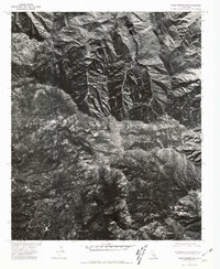
1975 Map of Palm Springs SW
USGS Topo · Published 1981About this map
San Jacinto Peak anchors this mid-1970s orthophotoquad, which utilizes aerial imagery taken by the Soil Conservation Service to provide a detailed view of the high-altitude landscape southwest of Palm Springs. Unlike traditional topographic maps, this imagery-based study reveals the exact density of forest cover and the intricate drainage patterns of Snow Creek as they descend from the granite heights. To the south, the early footprint of mountain settlements is visible at Pine Cove and Fern Valley, showing how residential development began to thread through the timbered slopes long before the modern expansion of these resort communities. The map captures a specific moment in the environmental history of the San Jacinto Mountains, documenting the interface between the high wilderness and the emerging foothill enclaves.
Find a feature on this map
4 named features on this map. Tap any name to fly to it.
Don’t see what you’re looking for? This feature index may not catch every label — zoom into the map to look around manually.
Map Details
Editions of this 1975 Palm Springs SW Map
This is the sole edition of this map. No revisions or reprints were ever made.
Other maps of this area

1901 · Southern California Sheet No. 1
USGS Topo · 1:250,000

1901 · San Jacinto
USGS Topo · 1:125,000

1904 · Southern California Sheet No. 1
USGS Topo · 1:250,000

1940 · Palm Springs
USGS Topo · 1:62,500

1940 · Hemet Reservoir
USGS Topo · 1:62,500

1942 · Banning
USGS Topo · 1:62,500

1942 · Hemet Reservoir
USGS Topo · 1:62,500

1942 · Hemet
USGS Topo · 1:62,500

1943 · Hemet
USGS Topo · 1:62,500

1943 · Banning
USGS Topo · 1:62,500
Featured Places
- Palm Springs, CA
- Idyllwild-Pine Cove, CA
- Pine Wood, CA
- Pine Cove, Idyllwild-Pine Cove
- Fern Valley, Idyllwild-Pine Cove