2024 Map of Palmdale
USGS Topo · Published 2024About this map
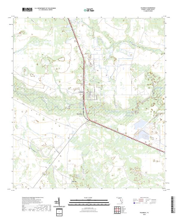
Fisheating Creek winds through the heart of this Glades County landscape, serving as the central artery for a sprawling network of wetlands and marshes. The map documents the rural settlements of Palmdale and Harrisburg, showing a grid of streets like Broadway St and Main Ave near the local Po. This area is dominated by the Fisheating Creek Wildlife Management Area, a vast natural corridor punctuated by landmarks like Picnic Lake and Rock Lake. To the south, the settlement of Hall City sits near Pens Marsh, illustrating the scattered nature of habitation in this part of Florida. The presence of the Herbert Hoover Dike in the southeast corner indicates the complex water management systems integrated into the terrain, while features like Gopher Gully and York Branch define the local drainage patterns into Cowbone Marsh.
Find a feature on this map
36 named features on this map. Tap any name to fly to it.
Don’t see what you’re looking for? This feature index may not catch every label — zoom into the map to look around manually.
Map Details
Editions of this 2024 Palmdale Map
This is the sole edition of this map. No revisions or reprints were ever made.
Other maps of this area

1953 · Brighton SW
USGS Topo · 1:24,000

1956 · West Palm Beach
USGS Topo · 1:250,000

1956 · Fort Pierce
USGS Topo · 1:250,000

1957 · West Palm Beach
USGS Topo · 1:250,000

1957 · Venus
USGS Topo · 1:24,000

1957 · Venus SW
USGS Topo · 1:24,000

1958 · Fort Pierce
USGS Topo · 1:250,000

1958 · West Palm Beach
USGS Topo · 1:250,000

1958 · La Belle NW
USGS Topo · 1:24,000

1958 · Goodno
USGS Topo · 1:24,000