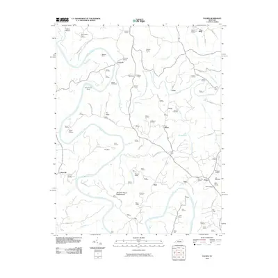
2010 Map of Palmer
USGS Topo · Published 2010About this map
The Kentucky River and Red River converge in this section of Clark County, creating a landscape defined by sharp river bends and high ridges. Significant water crossings such as Lilly's Ferry and Cobb Ferry emphasize the importance of river transit in this region, even as modern roads like Thornsburg Bend Rd follow the ancient contours of the land. Dramatic terrain features including the Devils Backbone, Iron Mountain, and Walters Ridge rise above the bottomlands of Marsha Bottom.
Find a feature on this map
105 named features on this map. Tap any name to fly to it.
Don’t see what you’re looking for? This feature index may not catch every label — zoom into the map to look around manually.
Map Details
Editions of this 2010 Palmer Map
This is the sole edition of this map. No revisions or reprints were ever made.
Other maps of this area

1892 · Richmond
USGS Topo · 1:125,000

1892 · Beattyville
USGS Topo · 1:125,000

1897 · Richmond
USGS Topo · 1:125,000

1950 · Levee
USGS Topo · 1:24,000

1952 · Union City
USGS Topo · 1:24,000

1952 · Palmer
USGS Topo · 1:24,000

1952 · Clay City
USGS Topo · 1:24,000

1952 · Levee
USGS Topo · 1:24,000

1952 · Winchester
USGS Topo · 1:24,000

1952 · Irvine
USGS Topo · 1:24,000