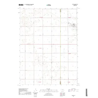
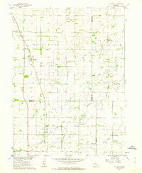
2017 Map of Palmer
USGS Topo · Published 2017About this map
Palmer serves as the primary hub in this corner of the Nebraska plains, positioned along the eastern edge of the survey where local streets like Commercial St and Zurich St define the village center. The surrounding landscape is characterized by a precise grid of rural routes, including Denton Rd, Cody Rd, and Brady Rd, which facilitate movement across the agricultural terrain. This 2017 survey reveals the intersection of Howard and Merrick counties, a border marked by a north-south line that splits the township ranges. To the west of the settlement, Rose Hill Cem provides a point of genealogical interest, while the winding course of Elk Cr breaks the geometric regularity of the section lines. The map illustrates a contemporary rural economy where modern infrastructure follows the legacy of early land divisions.
Find a feature on this map
37 named features on this map. Tap any name to fly to it.
Don’t see what you’re looking for? This feature index may not catch every label — zoom into the map to look around manually.
Map Details
Editions of this 2017 Palmer Map
This is the sole edition of this map. No revisions or reprints were ever made.
Other maps of this area

1899 · St. Paul
USGS Topo · 1:125,000

1955 · Belgrade SW
USGS Topo · 1:24,000

1955 · Broken Bow
USGS Topo · 1:250,000

1955 · Wolbach SW
USGS Topo · 1:24,000

1955 · Cushing
USGS Topo · 1:24,000

1956 · Broken Bow
USGS Topo · 1:250,000
1960 · St. Paul
USGS Topo · 1:24,000
1961 · Palmer
USGS Topo · 1:24,000
1961 · St. Paul SW
USGS Topo · 1:24,000
1961 · St. Libory
USGS Topo · 1:24,000