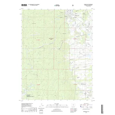
2019 Map of Palmer Lake
USGS Topo · Published 2019About this map
Palmer Lake and the neighboring community of Monument anchor the northeastern portion of this study, positioned where the high plains meet the steep eastern face of the Rampart Range. The area is characterized by dramatic sandstone formations and significant water management features, including the Lower Reservoir and Palmer Lake Number 2, which reflect the region's importance as a mountain water source. The presence of the New Santa Fe Regional Trail and the southern reach of the USAF Academy grounds near Deadmans Lake highlights the transition from recreational wilderness to institutional and residential land use.
Find a feature on this map
84 named features on this map. Tap any name to fly to it.
Don’t see what you’re looking for? This feature index may not catch every label — zoom into the map to look around manually.
Map Details
Editions of this 2019 Palmer Lake Map
This is the sole edition of this map. No revisions or reprints were ever made.
Other maps of this area

1893 · Platte Canyon
USGS Topo · 1:125,000

1893 · Colorado Springs
USGS Topo · 1:125,000

1894 · Pikes Peak
USGS Topo · 1:125,000

1894 · Castle Rock
USGS Topo · 1:125,000

1901 · Pikes Peak
USGS Topo · 1:125,000

1901 · Pikes Peak
USGS Topo · 1:62,500

1909 · Colorado Springs
USGS Topo · 1:125,000

1913 · Castle Rock
USGS Topo · 1:125,000

1942 · Colorado Springs
USGS Topo · 1:125,000

1948 · Colorado Springs
USGS Topo · 1:62,500