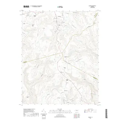
2019 Map of Palmer
USGS Topo · Published 2019About this map
Palmer and the surrounding mining and agricultural communities on the Cumberland Plateau are documented here in detail. This modern survey illustrates the persistent settlement patterns of Grundy County, where family history is etched into the landscape at Palmer City Cem and White Cem. The map tracks the complex topography of the Tennessee Valley Divide, where water flows away from ridges like Butterstack Ridge into a network of steep coves and gulfs. Deep incisions such as Elder Thicket Gulf and Bearpen Gulf define the local geography, separating highland settlements from the valley floor. Researchers can trace rural connectivity through a web of local routes including Sawmill Rd and McNabb Rd, which link the primary residential hubs to remote landmarks like Cow Rock and the southern reaches of The Pocket.
Find a feature on this map
89 named features on this map. Tap any name to fly to it.
Don’t see what you’re looking for? This feature index may not catch every label — zoom into the map to look around manually.
Map Details
Editions of this 2019 Palmer Map
This is the sole edition of this map. No revisions or reprints were ever made.
Other maps of this area

1888 · Chattanooga
USGS Topo · 1:125,000

1893 · Chattanooga
USGS Topo · 1:125,000

1895 · Sewanee
USGS Topo · 1:125,000

1936 · Palmer
USGS Topo · 1:24,000

1936 · Daus
USGS Topo · 1:24,000

1936 · Whitwell
USGS Topo · 1:24,000

1936 · Tracy City
USGS Topo · 1:24,000

1936 · Ketner Gap
USGS Topo · 1:24,000

1936 · White City
USGS Topo · 1:24,000
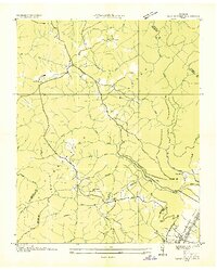
1936 · Savage Point
USGS Topo · 1:24,000