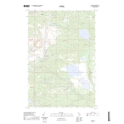
2023 Map of Palmer
USGS Topo · Published 2023About this map
The Empire Mine operations dominate the western landscape of this Marquette County survey, illustrating the scale of iron ore extraction in the Upper Peninsula. Centered on the community of Palmer, the map details a complex network of industrial roads like Empire Mine Rd and Tracy Mine Rd that navigate the varied elevations between Kona Hills and Wewe Hills. Local civic life is anchored by the Palmer Ch and Palmer Sch, while the northern edge of the sheet captures the southern outskirts of Negaunee, including the Negaunee Cem. The region's hydrography is defined by substantial bodies of water such as Lake Gribben and Goose Lake, with the East Branch Escanaba River winding through the southern reaches. Numerous cascades, including Warner Falls and Schweitzer Falls, emphasize the steep grades of the regional drainage basins.
Find a feature on this map
60 named features on this map. Tap any name to fly to it.
Don’t see what you’re looking for? This feature index may not catch every label — zoom into the map to look around manually.
Map Details
Editions of this 2023 Palmer Map
This is the sole edition of this map. No revisions or reprints were ever made.
Other maps of this area

1907 · Marquette
USGS Topo · 1:62,500

1932 · Harvey NW
USGS Topo · 1:31,680

1932 · Harvey SW
USGS Topo · 1:31,680

1952 · Sands
USGS Topo · 1:24,000

1952 · Ishpeming
USGS Topo · 1:62,500

1952 · Ishpeming
USGS Topo · 1:24,000

1952 · Gwinn
USGS Topo · 1:62,500

1952 · Palmer
USGS Topo · 1:24,000

1952 · Gwinn
USGS Topo · 1:24,000

1953 · Negaunee
USGS Topo · 1:24,000