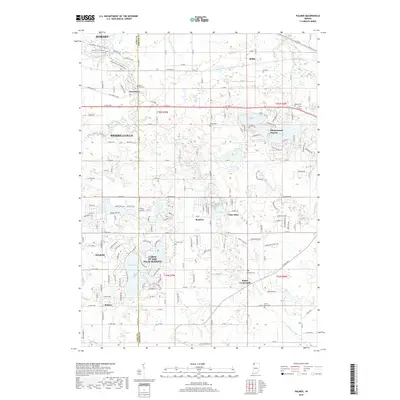
2019 Map of Palmer
USGS Topo · Published 2019About this map
Deep River and its accompanying Deep River Cem anchor the northern landscape of this survey, where the historic Old Lincoln Hwy crosses the border of Lake and Porter counties. This map documents a transitional geography where traditional rural settlements like Sedley and Beatrice meet the evolving suburban footprints of Shorewood Forest and the large residential development of Lakes of the Four Seasons. The topography is defined by complex water management, featuring various drainage works such as Cornell Ditch, Ludington Ditch, and Peregrine Ditch. To the south, the settlement of Palmer and the Porter Crossroads provide clear reference points for those studying the regional history between Merrillville and Hobart. Multiple small family and community cemeteries, including Lantz Shurr Cem and Frame Cem, are meticulously recorded across the townships.
Find a feature on this map
74 named features on this map. Tap any name to fly to it.
Don’t see what you’re looking for? This feature index may not catch every label — zoom into the map to look around manually.
Map Details
Editions of this 2019 Palmer Map
This is the sole edition of this map. No revisions or reprints were ever made.
Other maps of this area

1900 · Toleston
USGS Topo · 1:62,500

1934 · Porter
USGS Topo · 1:48,000

1940 · Porter
USGS Topo · 1:62,500

1953 · Leroy
USGS Topo · 1:24,000

1953 · Palmer
USGS Topo · 1:24,000

1953 · Gary
USGS Topo · 1:24,000

1953 · Crown Point
USGS Topo · 1:24,000

1953 · Hebron
USGS Topo · 1:24,000

1953 · Garyton
USGS Topo · 1:24,000

1953 · Valparaiso
USGS Topo · 1:24,000