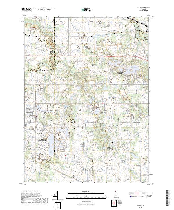
2022 Map of Palmer
USGS Topo · Published 2022About this map
Deep River winds through the northwestern corner of this landscape, connecting the suburban growth of Merrillville and Hobart with the more scattered residential clusters to the south and east. The area is defined by its numerous planned water features and residential developments, most notably the expansive Lakes of the Four Seasons and Shorewood Forest near Lake Louise. These late-twentieth-century developments contrast with the older rural framework still visible in the network of county roads and historic burial sites such as Deep River Cem, Guernsey Cem, and Frame Cem.
Find a feature on this map
182 named features on this map. Tap any name to fly to it.
Don’t see what you’re looking for? This feature index may not catch every label — zoom into the map to look around manually.
Map Details
Editions of this 2022 Palmer Map
This is the sole edition of this map. No revisions or reprints were ever made.
Other maps of this area

1900 · Toleston
USGS Topo · 1:62,500

1934 · Porter
USGS Topo · 1:48,000

1940 · Porter
USGS Topo · 1:62,500

1953 · Leroy
USGS Topo · 1:24,000

1953 · Palmer
USGS Topo · 1:24,000

1953 · Gary
USGS Topo · 1:24,000

1953 · Crown Point
USGS Topo · 1:24,000

1953 · Hebron
USGS Topo · 1:24,000

1953 · Garyton
USGS Topo · 1:24,000

1953 · Valparaiso
USGS Topo · 1:24,000