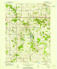
1953 Map of Palmer
USGS Topo · Published 1955About this map
Lake Eliza serves as a central landmark in this mid-century portrait of Porter County, where small agricultural settlements are connected by a dense network of major railroads. The landscape is defined by the crossing paths of the Pennsylvania, Grand Trunk, Chesapeake and Ohio, and Erie lines, illustrating the region's importance as a transportation corridor south of the Indiana Dunes.
Find a feature on this map
28 named features on this map. Tap any name to fly to it.
Don’t see what you’re looking for? This feature index may not catch every label — zoom into the map to look around manually.
Map Details
Editions of this 1953 Palmer Map
This is the sole edition of this map. No revisions or reprints were ever made.
Other maps of this area
1900 · Toleston
USGS Topo · 1:62,500
1934 · Porter
USGS Topo · 1:48,000
1940 · Porter
USGS Topo · 1:62,500
1953 · Leroy
USGS Topo · 1:24,000
1953 · Gary
USGS Topo · 1:24,000
1953 · Crown Point
USGS Topo · 1:24,000
1953 · Hebron
USGS Topo · 1:24,000
1953 · Garyton
USGS Topo · 1:24,000
1953 · Valparaiso
USGS Topo · 1:24,000
1953 · Chesterton
USGS Topo · 1:24,000