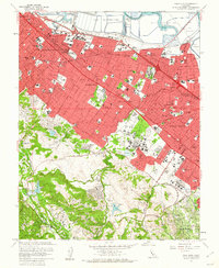
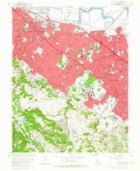
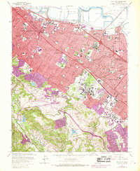
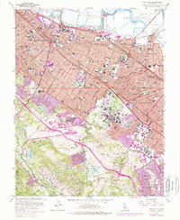
1961 Map of Palo Alto
USGS Topo · Published 1962About this map
The sprawling campus of Stanford University anchors the southern half of this mid-century survey, featuring The Quadrangle, a Mausoleum, and a Stadium before the area's modern densification. Along the shoreline, Salt Evaporators and extensive sloughs like Ravenswood Slough and Westpoint Slough define the edge of the San Francisco Bay, providing a stark contrast to the rapidly expanding residential grids of Redwood City and Palo Alto.
Find a feature on this map
129 named features on this map. Tap any name to fly to it.
Don’t see what you’re looking for? This feature index may not catch every label — zoom into the map to look around manually.
Map Details
Editions of this 1961 Palo Alto Map
4 editions found
Other maps of this area

1892 · San Mateo
USGS Topo · 1:62,500

1896 · San Mateo
USGS Topo · 1:62,500

1897 · Palo Alto
USGS Topo · 1:62,500

1899 · Palo Alto
USGS Topo · 1:62,500

1899 · Haywards
USGS Topo · 1:62,500

1899 · San Mateo
USGS Topo · 1:62,500

1902 · Santa Cruz
USGS Topo · 1:125,000

1915 · San Mateo
USGS Topo · 1:62,500

1915 · Haywards
USGS Topo · 1:62,500

1939 · San Mateo
USGS Topo · 1:62,500