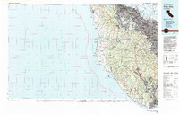
1982 Map of Palo Alto
USGS Topo · Published 1983About this map
The Santa Cruz Mountains dominate this 1982 survey, separating the urbanized San Francisco Bay coastline from the rural, rugged Pacific shore. On the eastern slopes, the sprawling campuses of Stanford University and the residential corridors of Palo Alto, Menlo Park, and Los Altos represent the rapid suburban expansion of the late 20th century. High above the valley, Skyline Blvd traces the ridgeline, providing access to a massive network of protected lands including Big Basin Redwoods State Park and Portola State Park. Along the coast, small settlements like Half Moon Bay and Davenport Landing remain largely isolated from the Silicon Valley growth by the steep terrain. The map captures a landscape in transition, where the industrial legacy of the Southern Pacific railroad meets the emerging conservation efforts of the San Francisco State Fish and Game Refuge.
Find a feature on this map
84 named features on this map. Tap any name to fly to it.
Don’t see what you’re looking for? This feature index may not catch every label — zoom into the map to look around manually.
Map Details
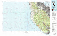
Editions of this 1982 Palo Alto Map
2 editions found
Other maps of this area

1889 · San Jose
USGS Topo · 1:62,500

1892 · San Mateo
USGS Topo · 1:62,500

1896 · San Mateo
USGS Topo · 1:62,500

1897 · San Jose
USGS Topo · 1:62,500

1897 · Palo Alto
USGS Topo · 1:62,500

1899 · San Jose
USGS Topo · 1:62,500

1899 · Palo Alto
USGS Topo · 1:62,500

1899 · Haywards
USGS Topo · 1:62,500

1899 · San Mateo
USGS Topo · 1:62,500

1902 · Santa Cruz
USGS Topo · 1:125,000