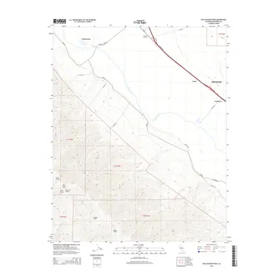
2015 Map of Palo Escrito Peak
USGS Topo · Published 2015About this map
The Salinas River valley serves as a geographic divide in this 2015 study, separating the agricultural lowlands from the high peaks of the Sierra de Salinas. To the north and east, the valley floor is anchored by the rail and road hubs of Gonzales and Soledad, with smaller waypoints like Molus and Camphora dotting the corridor. The rural cemetery at Gonzales Cemetery sits just north of the junction where Tavernetti Rd meets the main thoroughfare. Moving southwest, the terrain rises sharply toward the summits of Palo Escrito Peak and Paloma Mtn. This landscape is marked by deep cuts such as Bear Canyon and Slate Canyon, illustrating the transition from the fertile river basin to the ridges of the Paloma Ridge and the Rana Creek drainage.
Find a feature on this map
30 named features on this map. Tap any name to fly to it.
Don’t see what you’re looking for? This feature index may not catch every label — zoom into the map to look around manually.
Map Details
Editions of this 2015 Palo Escrito Peak Map
This is the sole edition of this map. No revisions or reprints were ever made.
Other maps of this area

1910 · Gonzales
USGS Topo · 1:31,680

1910 · Salinas
USGS Topo · 1:31,680

1910 · Soledad
USGS Topo · 1:31,680

1912 · Salinas
USGS Topo · 1:62,500

1915 · Soledad
USGS Topo · 1:62,500

1920 · Jamesburg
USGS Topo · 1:48,000

1921 · Jamesburg
USGS Topo · 1:62,500

1921 · Gonzales
USGS Topo · 1:62,500

1939 · Jamesburg
USGS Topo · 1:62,500

1940 · Salinas
USGS Topo · 1:62,500