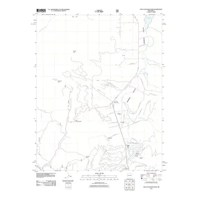
2011 Map of Palo Flechado Pass
USGS Topo · Published 2011About this map
Palo Flechado Pass serves as a critical geographic divide in this high-altitude landscape of Colfax County, where the southern reaches of the Moreno Valley meet the southern Sangre de Cristo Mountains. By the early 21st century, the area had transitioned into a significant recreation hub, anchored by the development of Angel Fire and its accompanying Angel Fire Resort. The map documents a complex network of residential roads like Camino Del Rey and Valley Grand Rd winding through the foothills, alongside major facilities like the Angel Fire Airport.
Find a feature on this map
70 named features on this map. Tap any name to fly to it.
Don’t see what you’re looking for? This feature index may not catch every label — zoom into the map to look around manually.
Map Details
Editions of this 2011 Palo Flechado Pass Map
This is the sole edition of this map. No revisions or reprints were ever made.
Other maps of this area

1954 · Raton
USGS Topo · 1:250,000

1955 · Ute Park
USGS Topo · 1:62,500

1956 · Tooth Of Time
USGS Topo · 1:62,500

1958 · Raton
USGS Topo · 1:250,000

1963 · Wheeler Peak
USGS Topo · 1:24,000

1963 · Eagle Nest
USGS Topo · 1:24,000

1965 · Osha Mountain
USGS Topo · 1:24,000

1965 · Palo Flechado Pass
USGS Topo · 1:24,000

1965 · Pueblo Peak
USGS Topo · 1:24,000

1965 · Shady Brook
USGS Topo · 1:24,000