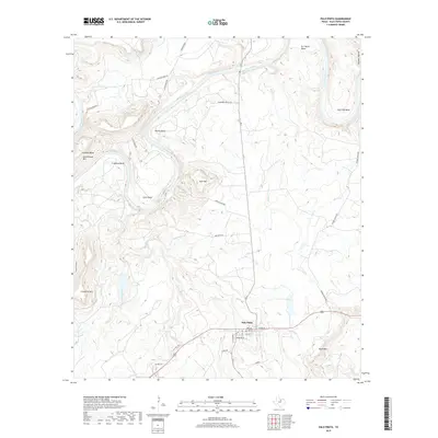
2019 Map of Palo Pinto
USGS Topo · Published 2019About this map
The settlement of Palo Pinto anchors the southern portion of this landscape, situated near the confluence of Town Br and other local drainage. This area is characterized by the dramatic winding path of the Brazos River, which creates a series of prominent land features such as Fortune Bend, Dalton Bend, and Chick Bend. These river loops dictate the local road network, with routes like Fortune Bend Rd and Chick Bend Rd following the topography of the water's edge. Rising above the river valley are several named peaks, including Kyle Mtn, Schoolhouse Mtn, and Crawford Mtn. The town itself maintains a classic grid centered around Cedar St and Oak St, while rural properties and landmarks like Wynn Mtn and Birdwell Hollow extend into the surrounding hills. This 2019 survey captures the persistent rural character of the county seat and the enduring geographical influence of the river bends.
Find a feature on this map
39 named features on this map. Tap any name to fly to it.
Don’t see what you’re looking for? This feature index may not catch every label — zoom into the map to look around manually.
Map Details
Editions of this 2019 Palo Pinto Map
This is the sole edition of this map. No revisions or reprints were ever made.
Other maps of this area

1891 · Palo Pinto
USGS Topo · 1:125,000

1918 · Palo Pinto
USGS Topo · 1:125,000

1924 · Palo Pinto 2-b
USGS Topo · 1:48,000

1924 · Palo Pinto 2-a
USGS Topo · 1:48,000

1924 · Palo Pinto 1-b
USGS Topo · 1:48,000

1924 · Palo Pinto 2-c
USGS Topo · 1:48,000

1925 · Palo Pinto 4-b
USGS Topo · 1:48,000

1927 · Pickwick
USGS Topo · 1:62,500

1927 · Mineral Wells
USGS Topo · 1:62,500

1931 · Santo
USGS Topo · 1:62,500