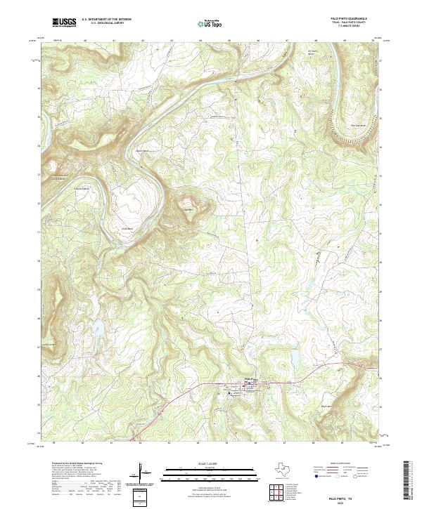
2022 Map of Palo Pinto
USGS Topo · Published 2022About this map
Palo Pinto serves as the focal point of this North Texas survey, positioned along the southern edge of a landscape defined by the deep meanders of the Brazos River. The town layout is anchored by the Palo Pinto County Courthouse and the nearby Palo Pinto Cem, providing a clear view of the county seat’s modern configuration. The river's winding path north of town creates several named peninsulas and geographical landmarks such as Chick Bend, Dalton Bend, and B C Harris Bend, which highlight the intricate drainage patterns of the region.
Find a feature on this map
36 named features on this map. Tap any name to fly to it.
Don’t see what you’re looking for? This feature index may not catch every label — zoom into the map to look around manually.
Map Details
Editions of this 2022 Palo Pinto Map
This is the sole edition of this map. No revisions or reprints were ever made.
Other maps of this area

1891 · Palo Pinto
USGS Topo · 1:125,000

1918 · Palo Pinto
USGS Topo · 1:125,000

1924 · Palo Pinto 2-b
USGS Topo · 1:48,000

1924 · Palo Pinto 2-a
USGS Topo · 1:48,000

1924 · Palo Pinto 1-b
USGS Topo · 1:48,000

1924 · Palo Pinto 2-c
USGS Topo · 1:48,000

1925 · Palo Pinto 4-b
USGS Topo · 1:48,000

1927 · Pickwick
USGS Topo · 1:62,500

1927 · Mineral Wells
USGS Topo · 1:62,500

1931 · Santo
USGS Topo · 1:62,500