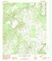
1984 Map of Palo Pinto
USGS Topo · Published 1984About this map
The community of Palo Pinto serves as the focal point for this survey, situated south of the dramatic, winding loops of the Brazos River. This 1984 map captures the landscape in a transitional period, showing the intersection of local watercourses like Town Branch and Eagle Creek as they drain toward the river. The topography is defined by prominent elevations such as Kyle Mountain and Wynn Mountain, while the winding river creates distinct peninsulas like Dalton Bend, Chick Bend, and Crawford Bend.
Find a feature on this map
19 named features on this map. Tap any name to fly to it.
Don’t see what you’re looking for? This feature index may not catch every label — zoom into the map to look around manually.
Map Details
Editions of this 1984 Palo Pinto Map
This is the sole edition of this map. No revisions or reprints were ever made.
Other maps of this area

1891 · Palo Pinto
USGS Topo · 1:125,000

1918 · Palo Pinto
USGS Topo · 1:125,000

1924 · Palo Pinto 2-b
USGS Topo · 1:48,000

1924 · Palo Pinto 2-a
USGS Topo · 1:48,000

1924 · Palo Pinto 1-b
USGS Topo · 1:48,000

1924 · Palo Pinto 2-c
USGS Topo · 1:48,000

1925 · Palo Pinto 4-b
USGS Topo · 1:48,000

1927 · Pickwick
USGS Topo · 1:62,500

1927 · Mineral Wells
USGS Topo · 1:62,500

1931 · Santo
USGS Topo · 1:62,500