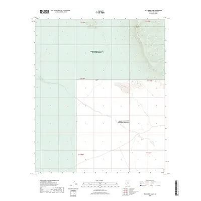
2018 Map of Palo Verde Camp
USGS Topo · Published 2018About this map
Palo Verde Camp sits at the intersection of protected desert landscapes in Pima County, marking a remote transition between the Cabeza Prieta National Wildlife Refuge to the west and the Organ Pipe Cactus National Monument to the southeast. The terrain is dominated by the steep, rising slopes of the Growler Mountains in the northeast, which give way to the expansive drainage of the Growler Valley. The ephemeral Growler Wash meanders across the central and southern portions of the sheet, illustrating the hydraulic patterns that define this arid environment. This 2018 survey detail provides a clear view of the complex boundary lines and section markers of the Public Land Survey System, including t14s r8w and t15s r7w, which are essential for property and resource management in this sensitive conservation area.
Find a feature on this map
12 named features on this map. Tap any name to fly to it.
Don’t see what you’re looking for? This feature index may not catch every label — zoom into the map to look around manually.
Map Details
Editions of this 2018 Palo Verde Camp Map
This is the sole edition of this map. No revisions or reprints were ever made.
Other maps of this area

1932 · Ajo
USGS Topo · 1:62,500

1934 · Ajo
USGS Topo · 1:62,500

1953 · Ajo
USGS Topo · 1:250,000

1957 · Ajo
USGS Topo · 1:250,000

1958 · Ajo
USGS Topo · 1:250,000

1962 · Ajo
USGS Topo · 1:250,000

1963 · Ajo
USGS Topo · 1:250,000

1963 · Ajo
USGS Topo · 1:62,500

1963 · Kino Peak
USGS Topo · 1:62,500

1964 · Growler Peak
USGS Topo · 1:62,500