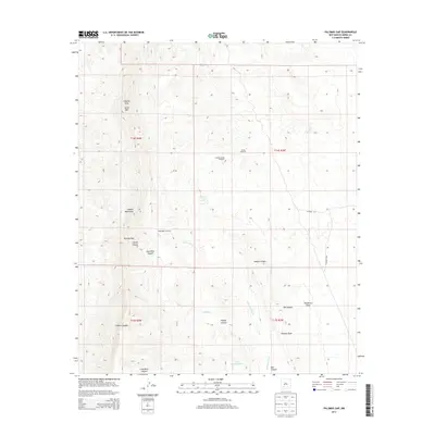
2013 Map of Palomas Gap
USGS Topo · Published 2013About this map
The Caballo Mountains define this arid landscape, dominated by deep-cut drainage systems and high peaks like Caballo Cone and Turtle Mtn. The rugged terrain is characterized by numerous steep canyons, including Caballo Canyon, Mescal Canyon, and Hadley Canyon. This 2013 survey illustrates the essential role of water management in the high desert, documenting a network of isolated water sources such as Mescal Spring, Ash Spring, and the Barney Lorio Number 1 Spring. The placement of the Parker Windmill, Caballo Spring Windmill, and Bootlegger Windmill suggests a long-standing reliance on groundwater to support ranching or local operations. Cultural history is hinted at through the nomenclature of Lead Mine Canyon, while the namesake Palomas Gap serves as a primary topographic landmark for navigating the range.
Find a feature on this map
27 named features on this map. Tap any name to fly to it.
Don’t see what you’re looking for? This feature index may not catch every label — zoom into the map to look around manually.
Map Details
Editions of this 2013 Palomas Gap Map
This is the sole edition of this map. No revisions or reprints were ever made.
Other maps of this area

1954 · Tularosa
USGS Topo · 1:250,000

1955 · Las Cruces
USGS Topo · 1:250,000

1958 · Las Cruces
USGS Topo · 1:250,000

1958 · Tularosa
USGS Topo · 1:250,000

1958 · Elephant Butte
USGS Topo · 1:24,000

1959 · Engle
USGS Topo · 1:62,500

1959 · Upham
USGS Topo · 1:62,500

1961 · Caballo
USGS Topo · 1:24,000

1961 · Williamsburg
USGS Topo · 1:24,000

1961 · Cuchillo
USGS Topo · 1:24,000