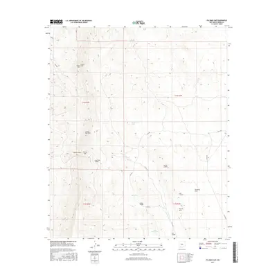
2017 Map of Palomas Gap
USGS Topo · Published 2017About this map
The Caballo Mountains dominate this high-desert landscape in Sierra County, defining a region where water sources were critical for early settlement and ranching. Named springs like Mescal Spring, Ash Spring, and Barney-Lorio Number 1 Spring provide vital points of interest for local history, marking the few reliable water points in a terrain of deep draws and canyons. The presence of Lead Mine Canyon suggests the area's mineral prospects, while prominent peaks like Turtle Mtn and Caballo Cone serve as clear navigational landmarks.
Find a feature on this map
27 named features on this map. Tap any name to fly to it.
Don’t see what you’re looking for? This feature index may not catch every label — zoom into the map to look around manually.
Map Details
Editions of this 2017 Palomas Gap Map
This is the sole edition of this map. No revisions or reprints were ever made.
Other maps of this area

1954 · Tularosa
USGS Topo · 1:250,000

1955 · Las Cruces
USGS Topo · 1:250,000

1958 · Las Cruces
USGS Topo · 1:250,000

1958 · Tularosa
USGS Topo · 1:250,000

1958 · Elephant Butte
USGS Topo · 1:24,000

1959 · Engle
USGS Topo · 1:62,500

1959 · Upham
USGS Topo · 1:62,500

1961 · Caballo
USGS Topo · 1:24,000

1961 · Williamsburg
USGS Topo · 1:24,000

1961 · Cuchillo
USGS Topo · 1:24,000