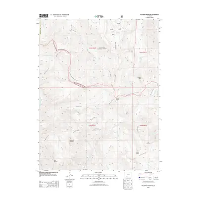
2013 Map of Palomino Mountain
USGS Topo · Published 2013About this map
The Continental Divide forms a jagged natural boundary across this high-elevation landscape in Mineral County, separating the Rio Grande National Forest from the San Juan National Forest. At the heart of the terrain, Palomino Mountain and Piedra Peak anchor a network of headwaters, including the Middle Fork Piedra River and the E Fork Piedra River. This 2013 survey illustrates a wilderness primarily accessible by a complex system of established paths such as the Continental Divide National Scenic Trail NST and the Middle Creek Trail 809. Small alpine water bodies, notably Window Lake and Monument Lake, are tucked into the high basins. The geography here is defined by significant relief, with Porphyry Gulch and Dark Canyon cutting through the slopes of Sugarloaf Mountain and Toner Mountain, providing a detailed view of the drainage patterns along the divide.
Find a feature on this map
41 named features on this map. Tap any name to fly to it.
Don’t see what you’re looking for? This feature index may not catch every label — zoom into the map to look around manually.
Map Details
Editions of this 2013 Palomino Mountain Map
This is the sole edition of this map. No revisions or reprints were ever made.
Other maps of this area

1905 · San Cristobal
USGS Topo · 1:125,000

1907 · San Cristobal
USGS Topo · 1:125,000

1913 · Summitville
USGS Topo · 1:125,000

1914 · Creede
USGS Topo · 1:125,000

1915 · Summitville
USGS Topo · 1:125,000

1916 · Creede
USGS Topo · 1:125,000

1924 · Pagosa Springs
USGS Topo · 1:125,000

1927 · Pagosa Springs
USGS Topo · 1:125,000

1945 · Durango
USGS Topo · 1:250,000

1953 · Durango
USGS Topo · 1:250,000