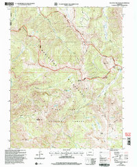
2001 Map of Palomino Mountain
USGS Topo · Published 2001About this map
The Continental Divide winds through this high-altitude landscape on the border of Mineral and Hinsdale counties, separating the drainage basins of the Rio Grande and San Juan National Forests. This 2001 revision, based on earlier surveys and updated imagery, centers on the protected reaches of the Weminuche Wilderness. The terrain is defined by prominent summits such as Palomino Mountain, Piedra Peak, and Sugarloaf Mountain, with the hydrological network of the Piedra River and its multiple forks feeding into alpine basins. Isolated water bodies like Monument Lake and Winslow Lake dot the interior, while a solitary Gaging Station on the river and the Pagosa Ranger District boundary indicate the managed nature of this wild land. The map serves as a detailed record of high-country topography before twenty-first-century environmental shifts, documenting trails like the Turkey Creek Trail and remote passes such as Puerto Blanco.
Find a feature on this map
31 named features on this map. Tap any name to fly to it.
Don’t see what you’re looking for? This feature index may not catch every label — zoom into the map to look around manually.
Map Details
Editions of this 2001 Palomino Mountain Map
This is the sole edition of this map. No revisions or reprints were ever made.
Other maps of this area

1905 · San Cristobal
USGS Topo · 1:125,000

1907 · San Cristobal
USGS Topo · 1:125,000

1913 · Summitville
USGS Topo · 1:125,000

1914 · Creede
USGS Topo · 1:125,000

1915 · Summitville
USGS Topo · 1:125,000

1916 · Creede
USGS Topo · 1:125,000

1924 · Pagosa Springs
USGS Topo · 1:125,000

1927 · Pagosa Springs
USGS Topo · 1:125,000

1945 · Durango
USGS Topo · 1:250,000

1953 · Durango
USGS Topo · 1:250,000