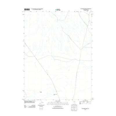
2012 Map of Palomino Ridge
USGS Topo · Published 2012About this map
Palomino Ridge defines the high ground of this Elko County landscape, where the high desert terrain is carved by ephemeral watercourses and remote access routes. The drainages of Rogers Cr and the evocatively named Robbers Roost Draw suggest the historical character of this area as a place of passage and concealment. Managed primarily by the Bureau of Land Management, the territory is crossed by several utility and access corridors, including Bureau of Land Mgmt Road 1516 and Bureau of Land Mgmt Road 1023. The layout of these tracks, including numerous unnamed BLM roads, illustrates the modern infrastructure required to navigate this portion of the Great Basin. This survey provides a precise look at the land's contours and vital water features before the continued expansion of regional resource management.
Find a feature on this map
6 named features on this map. Tap any name to fly to it.
Don’t see what you’re looking for? This feature index may not catch every label — zoom into the map to look around manually.
Map Details
Editions of this 2012 Palomino Ridge Map
This is the sole edition of this map. No revisions or reprints were ever made.
Other maps of this area

1953 · Spruce Mountain
USGS Topo · 1:62,500

1953 · Spruce Mountain 4
USGS Topo · 1:62,500

1955 · Elko
USGS Topo · 1:250,000

1958 · Elko
USGS Topo · 1:250,000

1962 · Elko
USGS Topo · 1:250,000

1965 · Elko
USGS Topo · 1:250,000

1982 · Currie
USGS Topo · 1:24,000

1982 · Mizpah
USGS Topo · 1:24,000

1984 · Currie Gardens
USGS Topo · 1:24,000

1984 · Silo Canyon
USGS Topo · 1:24,000