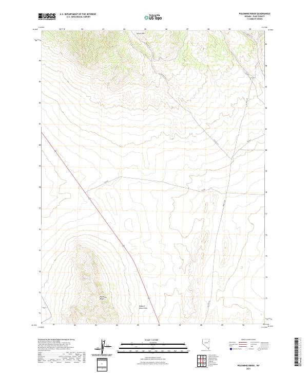
2021 Map of Palomino Ridge
USGS Topo · Published 2021About this map
Spruce Mtn towers over the northern reaches of this Elko County landscape, serving as a primary navigational landmark for the high desert terrain. The topography is defined by the elevation gain toward Palomino Ridge in the southwest and the drainage patterns of Robbers Roost Draw. This 2021 survey illustrates a region largely defined by public land management, where a network of Bureau of Land Management routes, including Blm Rd 1515 and Blm Rd 1516, provide the only access through the sagebrush and basin-and-range geography. The map captures the expansive township and range divisions, such as t30n r63e, which underpin the land ownership and survey history of this part of Nevada.
Find a feature on this map
11 named features on this map. Tap any name to fly to it.
Don’t see what you’re looking for? This feature index may not catch every label — zoom into the map to look around manually.
Map Details
Editions of this 2021 Palomino Ridge Map
This is the sole edition of this map. No revisions or reprints were ever made.
Other maps of this area

1953 · Spruce Mountain
USGS Topo · 1:62,500

1953 · Spruce Mountain 4
USGS Topo · 1:62,500

1955 · Elko
USGS Topo · 1:250,000

1958 · Elko
USGS Topo · 1:250,000

1962 · Elko
USGS Topo · 1:250,000

1965 · Elko
USGS Topo · 1:250,000

1982 · Currie
USGS Topo · 1:24,000

1982 · Mizpah
USGS Topo · 1:24,000

1984 · Currie Gardens
USGS Topo · 1:24,000

1984 · Silo Canyon
USGS Topo · 1:24,000