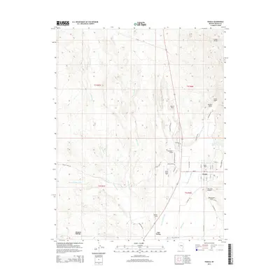
2014 Map of Panaca
USGS Topo · Published 2014About this map
Panaca serves as the central hub of this eastern Nevada landscape, where the grid of its historic streets meets the winding path of the Meadow Valley Wash. The town's reliance on local water sources is evident in the proximity of Panaca Spring and the nearby Lincoln County Airport, which sits just west of the residential core. To the north, the dramatic formations of Cathedral Gorge and Millers Point define the geology of the region, while the Bullionville Cem stands as a marker of the area's early settlement history. The terrain is deeply grooved by seasonal drainages such as Little Red Wash and Caselton Wash, which converge toward the valley floor. To the south, distinctive landmarks like Court Rock and The Little Hogback provide clear navigational points for those exploring the desert environment near Bennett Springs and Cold Spring.
Find a feature on this map
47 named features on this map. Tap any name to fly to it.
Don’t see what you’re looking for? This feature index may not catch every label — zoom into the map to look around manually.
Map Details
Editions of this 2014 Panaca Map
This is the sole edition of this map. No revisions or reprints were ever made.
Other maps of this area

1885 · Pioche
USGS Topo · 1:250,000

1886 · Pioche
USGS Topo · 1:250,000

1916 · Highland
USGS Topo · 1:62,500

1918 · Highland
USGS Topo · 1:62,500

1921 · NW 1/4 Panaca
USGS Topo · 1:48,000

1953 · Highland Peak
USGS Topo · 1:24,000

1953 · Pioche
USGS Topo · 1:24,000

1954 · Caliente
USGS Topo · 1:250,000

1959 · Caliente
USGS Topo · 1:250,000
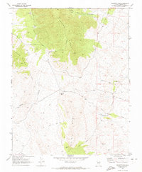
1970 · Bennett Pass
USGS Topo · 1:24,000