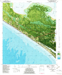
1982 Map of Panama City Beach
USGS Topo · Published 1984About this map
The coastal strip of Panama City Beach is captured in this orthophotomap during a period of significant development, showing the dense grid of vacation properties and residences stretching toward Gulf Lagoon Beach and Biltmore Beach. This 1982 edition integrates aerial photography with bathymetric data, revealing the intricate underwater topography of West Bay and St Andrew Bay alongside the terrestrial landscape. Civic life is anchored by locations like Hutchison School, St Bernadette Ch, and Pete Edwards Field. The map also details local infrastructure of the era, including a Landing Strip, several radio towers, and a Race Track. From the wetlands surrounding Botheration Bayou to the seawalls along the Gulf, the sheet documents the meeting of rapid urban growth and the Florida coastline.
Find a feature on this map
34 named features on this map. Tap any name to fly to it.
Don’t see what you’re looking for? This feature index may not catch every label — zoom into the map to look around manually.
Map Details
Editions of this 1982 Panama City Beach Map
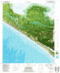
2 editions found
Other maps of this area

1943 · Beacon Beach
USGS Topo · 1:31,680

1943 · Laguna Beach
USGS Topo · 1:31,680

1943 · Panama City
USGS Topo · 1:31,680

1943 · Panama City Beach
USGS Topo · 1:31,680

1943 · Seminole Hills
USGS Topo · 1:24,000

1943 · West Bay
USGS Topo · 1:24,000

1943 · Southport
USGS Topo · 1:24,000

1944 · Southport
USGS Topo · 1:24,000

1944 · Seminole Hills
USGS Topo · 1:31,680

1944 · West Bay
USGS Topo · 1:31,680
Featured Places
- Panama City Beach, FL
- Lower Grand Lagoon, FL
- Biltmore Beach, FL
- Edgewater Gulf Beach, Panama City Beach
- Florida Beach, Panama City Beach