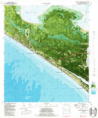
1982 Map of Panama City Beach
USGS Topo · Published 1984About this map
Panama City Beach and its neighboring coastal communities of Gulf Lagoon Beach and Biltmore Beach are captured here during a period of significant late-20th-century development. This orthophotomap combines aerial imagery with topographic data, revealing the dense grid of residential and commercial structures pressing against the white sands of the Gulf of Mexico. Inland from the Gulf, the landscape is defined by the intricate waterways of West Bay and St Andrew Bay, including the strangely named Botheration Bayou and Harrison Bayou. The map documents local community life through features like St Bernadette Ch, Hutchison School, and the recreational Golf Course. A U S Coast Guard presence and a Landing Strip near the northern marshes highlight the area's strategic coastal utility. The transition from the developed beach strip to the northern bayou-laced wetlands illustrates the environmental contrast that shaped the growth of Bay County.
Find a feature on this map
23 named features on this map. Tap any name to fly to it.
Don’t see what you’re looking for? This feature index may not catch every label — zoom into the map to look around manually.
Map Details
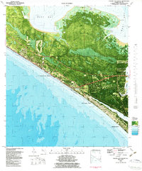
Editions of this 1982 Panama City Beach Map
2 editions found
Other maps of this area

1943 · Beacon Beach
USGS Topo · 1:31,680

1943 · Laguna Beach
USGS Topo · 1:31,680

1943 · Panama City
USGS Topo · 1:31,680

1943 · Panama City Beach
USGS Topo · 1:31,680

1943 · Seminole Hills
USGS Topo · 1:24,000

1943 · West Bay
USGS Topo · 1:24,000

1943 · Southport
USGS Topo · 1:24,000

1944 · Southport
USGS Topo · 1:24,000

1944 · Seminole Hills
USGS Topo · 1:31,680

1944 · West Bay
USGS Topo · 1:31,680
Featured Places
- Panama City Beach, FL
- Lower Grand Lagoon, FL
- Biltmore Beach, FL
- Edgewater Gulf Beach, Panama City Beach
- Florida Beach, Panama City Beach