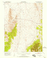
1951 Map of Pancake Summit
USGS Topo · Published 1958About this map
Mining operations and historical transport corridors define this mid-century look at the high desert of White Pine County. The Nevada National Forest covers the southeastern heights, where a cluster of industrial activity is centered around Mohawk Canyon and Seligman Canyon. Here, researchers can locate the Belmont Mill and several mining claims including the Seligman Mine, Jenny A Mines, and the Dog Star Mine.
Find a feature on this map
27 named features on this map. Tap any name to fly to it.
Don’t see what you’re looking for? This feature index may not catch every label — zoom into the map to look around manually.
Map Details
Editions of this 1951 Pancake Summit Map
3 editions found
Other maps of this area

1949 · Treasure Hill
USGS Topo · 1:62,500

1950 · Treasure Hill
USGS Topo · 1:62,500

1951 · Green Springs
USGS Topo · 1:62,500

1951 · Illipah
USGS Topo · 1:62,500

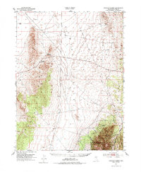
1951 · Pancake Summit
USGS Topo · 1:62,500

1953 · Pinto Summit
USGS Topo · 1:62,500

1953 · Eureka
USGS Topo · 1:62,500

1956 · Ely
USGS Topo · 1:250,000

1957 · Buck Mountain
USGS Topo · 1:62,500

1959 · Ely
USGS Topo · 1:250,000