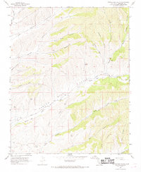
1967 Map of Pancho Rico Valley
USGS Topo · Published 1968About this map
Pancho Rico Valley is defined by a network of steep drainages and canyon floors in Monterey County, illustrating a landscape primarily dedicated to ranching and early petroleum extraction during the late 1960s. The southern portion of the map shows industrial activity with Oil Wells and a Well located near the small settlement of Lanigan. This area is characterized by numerous named canyons that suggest historical land use and family legacies, including Dutch Henry Canyon, Portugee Canyon, and Antone Canyon. Water sources were critical to life in this arid terrain, evidenced by the presence of Brinan Spring, Iron Springs, and several remote water tanks positioned along the hillsides. The mapping of numerous fence lines throughout the valley emphasizes the importance of livestock management, while the course of Pancho Rico Creek and the route of Peachtree Road provided the essential corridor for movement through these coastal hills.
Find a feature on this map
76 named features on this map. Tap any name to fly to it.
Don’t see what you’re looking for? This feature index may not catch every label — zoom into the map to look around manually.
Map Details
Editions of this 1967 Pancho Rico Valley Map
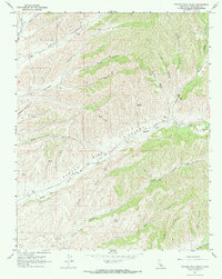
2 editions found
Other maps of this area

1912 · San Ardo
USGS Topo · 1:31,680

1915 · Priest Valley
USGS Topo · 1:125,000

1919 · San Miguel
USGS Topo · 1:62,500

1919 · Bradley
USGS Topo · 1:62,500

1941 · Priest Valley
USGS Topo · 1:62,500

1941 · San Ardo
USGS Topo · 1:62,500

1941 · Bradley
USGS Topo · 1:62,500

1943 · San Ardo
USGS Topo · 1:62,500

1944 · Priest Valley
USGS Topo · 1:62,500

1947 · San Luis Obispo
USGS Topo · 1:250,000