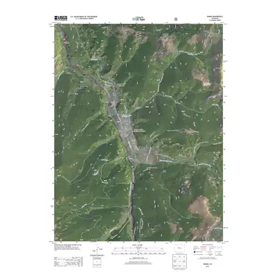
2013 Map of Pando
USGS Topo · Published 2013About this map
Camp Hale and the Pando valley are the central landmarks of this high-altitude landscape within the White River National Forest. As a critical site for military training during the 1940s, the area is commemorated by the Tenth Mtn Div Mem Hwy, which follows the path of the Eagle River. The complex topography is defined by significant summits like Hornsilver Mountain and Resolution Mountain, while the Continental Divide National Scenic Trail winds along the eastern ridges. Water management is evident through the presence of Wurts Ditch and the Columbine Ditch, which divert alpine flows across the terrain. Public recreation facilities, including the Homestake Campground and Camp Hale Recreation Area, sit alongside a network of specialized routes like the Pearl Creek Jeep Trail and Old Highway, reflecting the modern transition from a military installation to a mountain heritage site.
Find a feature on this map
61 named features on this map. Tap any name to fly to it.
Don’t see what you’re looking for? This feature index may not catch every label — zoom into the map to look around manually.
Map Details
Editions of this 2013 Pando Map
This is the sole edition of this map. No revisions or reprints were ever made.
Other maps of this area

1889 · Leadville
USGS Topo · 1:125,000

1891 · Leadville
USGS Topo · 1:125,000

1929 · Dillon
USGS Topo · 1:62,500

1934 · Climax
USGS Topo · 1:48,000

1934 · Minturn
USGS Topo · 1:62,500

1934 · Dillon
USGS Topo · 1:62,500

1938 · Mt. Lincoln
USGS Topo · 1:48,000

1942 · Leadville
USGS Topo · 1:125,000

1945 · Mount Lincoln
USGS Topo · 1:62,500

1949 · Holy Cross
USGS Topo · 1:62,500