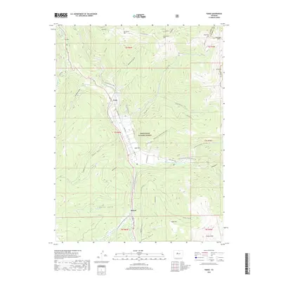
2019 Map of Pando
USGS Topo · Published 2019About this map
Camp Hale, a significant high-altitude military training site, occupies the wide valley floor of Eagle Park at the headwaters of the Eagle River. This area of the White River National Forest is defined by its deep alpine gulches and high ridges, with the Continental Divide National Scenic Trail tracing the eastern peaks from Ptarmigan Pass south toward Chicago Ridge. The settlement of Pando serves as a central point in this landscape, which is historically tied to the development of the mountain infantry training grounds during World War II. Throughout the terrain, water management systems like Wurts Ditch and a network of drainages such as McAllister Gulch and Taylor Gulch illustrate the complex hydrography required to support both the natural forest and the localized developments at Mitchell. The presence of the Pearl Creek Jeep road and Jackal Hut via Ranch Creek trail highlight the modern recreational use of this formerly intensive military training ground.
Find a feature on this map
47 named features on this map. Tap any name to fly to it.
Don’t see what you’re looking for? This feature index may not catch every label — zoom into the map to look around manually.
Map Details
Editions of this 2019 Pando Map
This is the sole edition of this map. No revisions or reprints were ever made.
Other maps of this area

1889 · Leadville
USGS Topo · 1:125,000

1891 · Leadville
USGS Topo · 1:125,000

1929 · Dillon
USGS Topo · 1:62,500

1934 · Climax
USGS Topo · 1:48,000

1934 · Minturn
USGS Topo · 1:62,500

1934 · Dillon
USGS Topo · 1:62,500

1938 · Mt. Lincoln
USGS Topo · 1:48,000

1942 · Leadville
USGS Topo · 1:125,000

1945 · Mount Lincoln
USGS Topo · 1:62,500

1949 · Holy Cross
USGS Topo · 1:62,500