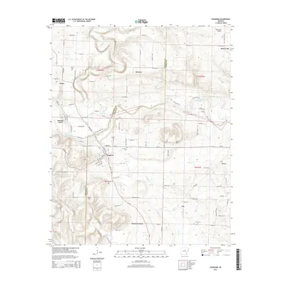
2014 Map of Pangburn
USGS Topo · Published 2014About this map
Pangburn serves as the central hub of this region, where the Little Red River cuts through the landscape, creating distinctive features like Rainbow Island. The terrain is defined by its watercourses and prominent elevations, including Bruce Mtn and Marsh Mtn, which overlook a network of rural settlements such as Hiram, McJester, and Clay. This 2014 survey reveals a transition from the winding river valley to the higher grounds of White Oak Hollow and Hickory Flat. For local historians and genealogists, the map provides precise locations for several community landmarks and burial grounds, such as Mt Zion church, Faulkner Cem, and Howell Cem. The grid of secondary roads and local routes like McJester Rd and Wilburn Rd illustrates how the population is distributed across the boundary of Cleburne and White counties, tied closely to the natural drainage of Big Creek and Brier Cr.
Find a feature on this map
91 named features on this map. Tap any name to fly to it.
Don’t see what you’re looking for? This feature index may not catch every label — zoom into the map to look around manually.
Map Details
Editions of this 2014 Pangburn Map
This is the sole edition of this map. No revisions or reprints were ever made.
Other maps of this area

1890 · Batesville
USGS Topo · 1:125,000

1891 · Batesville
USGS Topo · 1:125,000

1935 · Bald Knob
USGS Topo · 1:62,500

1953 · Memphis
USGS Topo · 1:250,000

1956 · Memphis
USGS Topo · 1:250,000

1962 · Pangburn
USGS Topo · 1:24,000

1962 · Letona
USGS Topo · 1:24,000

1963 · West Pangburn
USGS Topo · 1:24,000

1963 · Sidon
USGS Topo · 1:24,000

1965 · Pleasant Plains
USGS Topo · 1:24,000