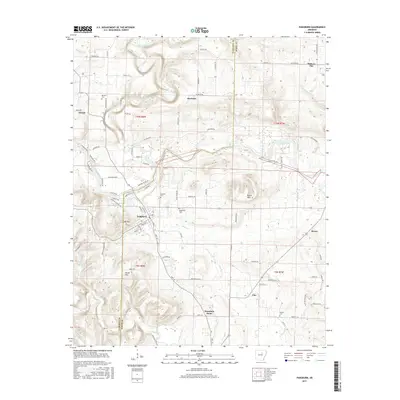
2017 Map of Pangburn
USGS Topo · Published 2017About this map
The Little Red River winds through the heart of this White County landscape, anchoring a region defined by scattered rural settlements and family-named landmarks. The town of Pangburn serves as the primary hub, where local streets meet the banks of Big Creek. Further north and east, smaller communities such as Hiram, McJester, and Clay mark the transition toward the higher ground of Bruce Mtn and Hickory Flat. This survey highlights the deep-rooted nature of the area's residency, noting several established burial grounds including Henderson Cem, Faulkner Cem, and Barnett Cem. The network of roads, such as Old River Rd and Hickory Flat Rd, follows the natural contours of the river valley, providing a clear record of local infrastructure and land use in the early 21st century.
Find a feature on this map
87 named features on this map. Tap any name to fly to it.
Don’t see what you’re looking for? This feature index may not catch every label — zoom into the map to look around manually.
Map Details
Editions of this 2017 Pangburn Map
This is the sole edition of this map. No revisions or reprints were ever made.
Other maps of this area

1890 · Batesville
USGS Topo · 1:125,000

1891 · Batesville
USGS Topo · 1:125,000

1935 · Bald Knob
USGS Topo · 1:62,500

1953 · Memphis
USGS Topo · 1:250,000

1956 · Memphis
USGS Topo · 1:250,000

1962 · Pangburn
USGS Topo · 1:24,000

1962 · Letona
USGS Topo · 1:24,000

1963 · West Pangburn
USGS Topo · 1:24,000

1963 · Sidon
USGS Topo · 1:24,000

1965 · Pleasant Plains
USGS Topo · 1:24,000