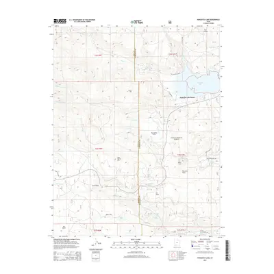
2014 Map of Panguitch Lake
USGS Topo · Published 2014About this map
Panguitch Lake Resort sits at the eastern edge of this high-elevation plateau, where the waters of Panguitch Lake meet the vast timberlands of the Dixie National Forest. The landscape is a complex of volcanic landforms and high valleys, defined by features like Blue Spring Mtn and the volcanic prominence of Miller Knoll. Drainage patterns are shaped by numerous seasonal and perennial flows, including Mammoth Cr and Bunker Cr, which carve through the volcanic geology of the Markagunt Plateau.
Find a feature on this map
50 named features on this map. Tap any name to fly to it.
Don’t see what you’re looking for? This feature index may not catch every label — zoom into the map to look around manually.
Map Details
Editions of this 2014 Panguitch Lake Map
This is the sole edition of this map. No revisions or reprints were ever made.
Other maps of this area

1886 · Kanab
USGS Topo · 1:250,000

1953 · Cedar City
USGS Topo · 1:250,000

1958 · Cedar City
USGS Topo · 1:250,000

1958 · Cedar Breaks
USGS Topo · 1:62,500

1958 · Panguitch Lake
USGS Topo · 1:62,500

1962 · Cedar City
USGS Topo · 1:250,000

1971 · Fivemile Ridge
USGS Topo · 1:24,000

1971 · Parowan
USGS Topo · 1:24,000
1971 · Red Creek Reservoir
USGS Topo · 1:24,000

1980 · Panguitch
USGS Topo · 1:100,000