
1966 Map of Panhandle West
USGS Topo · Published 1967About this map
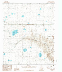
The town of Panhandle sits at the high point of this Carson County landscape, where the Atchison Topeka and Santa Fe railroad serves as the primary artery for the region's agricultural economy. This mid-century survey documents a transition in the High Plains, balancing the rail-based town structure with modern infrastructure like a sprawling Military Reservation and a regional Substation.
Find a feature on this map
13 named features on this map. Tap any name to fly to it.
Don’t see what you’re looking for? This feature index may not catch every label — zoom into the map to look around manually.
Map Details
Editions of this 1966 Panhandle West Map
This is the sole edition of this map. No revisions or reprints were ever made.
Other maps of this area

1953 · Pomeroy
USGS Topo · 1:24,000

1953 · Sevenmile Basin
USGS Topo · 1:24,000

1954 · Amarillo
USGS Topo · 1:250,000

1956 · Washburn
USGS Topo · 1:24,000

1958 · Amarillo
USGS Topo · 1:250,000

1960 · Claude
USGS Topo · 1:62,500

1965 · Abell
USGS Topo · 1:24,000

1966 · Panhandle East
USGS Topo · 1:24,000

1966 · Cuyler
USGS Topo · 1:24,000
1983 · Claude NE
USGS Topo · 1:24,000