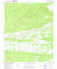
1979 Map of Panola
USGS Topo · Published 1980About this map
Panola serves as the central hub of this late-1970s survey, situated along the Chicago Rock Island and Pacific railroad line. The landscape is defined by the east-west orientation of several ridgelines, including the Sans Bois Mountains, Second Mountain, and First Mountain, which channel the Fourche Maline and its tributaries across the valley floor. The placement of Rocky Point Ch and Cravens Ch alongside features like Baldwin Cem and Baldwin Prairie suggests a settled rural corridor between the rising heights of Red Oak Ridge and Limestone Ridge. This era of the region's development is marked by industrial activity, visible through numerous gas wells and a Shale Pit, balanced by the local utility of a Fish Hatchery near Austin Lake. The terrain transitions through several notable topographical breaks such as Courthouse Gap and Buzzard Gap, which provided historical passage through the otherwise steep ridges.
Find a feature on this map
38 named features on this map. Tap any name to fly to it.
Don’t see what you’re looking for? This feature index may not catch every label — zoom into the map to look around manually.
Map Details
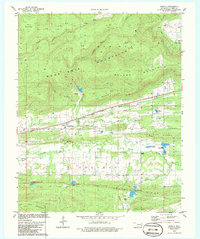
Editions of this 1979 Panola Map
2 editions found
Other maps of this area

1900 · Sansbois
USGS Topo · 1:125,000

1901 · Tuskahoma
USGS Topo · 1:125,000

1908 · Tuskahoma
USGS Topo · 1:125,000

1909 · Tuskahoma
USGS Topo · 1:125,000

1909 · Sans Bois
USGS Topo · 1:125,000

1911 · Sansbois
USGS Topo · 1:125,000

1940 · Red Oak
USGS Topo · 1:62,500

1943 · Red Oak
USGS Topo · 1:62,500

1946 · Fort Smith
USGS Topo · 1:250,000

1950 · Mcalester
USGS Topo · 1:250,000