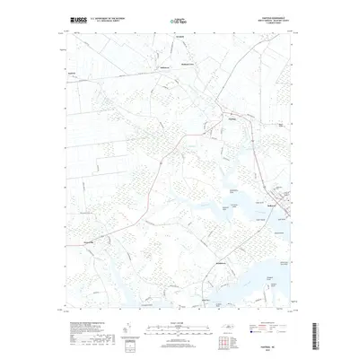
2019 Map of Pantego
USGS Topo · Published 2019About this map
Belhaven serves as the coastal anchor of this coastal North Carolina landscape, where the town street grid meets the waters of Pantego Creek and Shoemaker Cr. The region is defined by a dense network of canals and creeks, such as the Broad Creek Canal and Deep Run, which drain the low-lying interior toward the Pungo River. Smaller settlements like Pantego, Yeatesville, and Smithtown are linked by rural routes that navigate around terrain features like Hell Swamp. Genealogists may find interest in the location of Oddfellows Cem near the coast or family-named landmarks like Stotesberry Point and Gaylord. The map illustrates a landscape shaped by water, with numerous named points including Graveyard Point, Windmill Point, and Persimmon Tree Point jutting into the expansive Pungo Creek estuary.
Find a feature on this map
90 named features on this map. Tap any name to fly to it.
Don’t see what you’re looking for? This feature index may not catch every label — zoom into the map to look around manually.
Map Details
Editions of this 2019 Pantego Map
This is the sole edition of this map. No revisions or reprints were ever made.
Other maps of this area

1914 · Belhaven
USGS Topo · 1:48,000

1916 · Belhaven
USGS Topo · 1:62,500

1943 · Plymouth
USGS Topo · 1:125,000

1950 · Pinetown
USGS Topo · 1:24,000

1951 · Bath
USGS Topo · 1:24,000

1951 · Ransomville
USGS Topo · 1:24,000

1951 · Pamlico Beach
USGS Topo · 1:24,000

1951 · Belhaven
USGS Topo · 1:24,000

1951 · Pantego
USGS Topo · 1:24,000

1953 · Rocky Mount
USGS Topo · 1:250,000