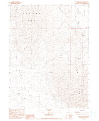
1990 Map of Panther Canyon
USGS Topo · Published 1990About this map
The Sonoma Range and the Tobin Range converge in this high-desert Nevada landscape, revealing a history of remote ranching and resource extraction. At the base of the mountains, the Mud Spring Ranch stands near Mud Spring, marking a critical water source in the arid Grass Valley. The topographic detail shows the transition from the steep, canyon-cut slopes of Panther Canyon and Sheep Ranch Canyon to the alluvial basins of Pumpernickel Valley to the east.
Find a feature on this map
24 named features on this map. Tap any name to fly to it.
Don’t see what you’re looking for? This feature index may not catch every label — zoom into the map to look around manually.
Map Details
Editions of this 1990 Panther Canyon Map
This is the sole edition of this map. No revisions or reprints were ever made.
Other maps of this area

1932 · Sonoma Range
USGS Topo · 1:250,000

1939 · Sonoma Range
USGS Topo · 1:250,000

1955 · Winnemucca
USGS Topo · 1:250,000

1958 · Winnemucca
USGS Topo · 1:250,000

1961 · Mt. Tobin
USGS Topo · 1:62,500

1961 · Leach Hot Springs
USGS Topo · 1:62,500

1962 · Winnemucca
USGS Topo · 1:250,000

1962 · Buffalo Springs
USGS Topo · 1:62,500
1965 · Smelser Pass
USGS Topo · 1:24,000
1965 · China Mountain
USGS Topo · 1:24,000