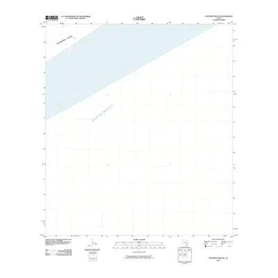
2010 Map of Panther Point NE
USGS Topo · Published 2010About this map
Matagorda Island defines the narrow coastal threshold shown here, separating the Texas mainland's interior waters from the open expanse of the Gulf of Mexico. This 2010 survey focuses on the northwestern edge of the Gulf, capturing the barrier island's shape and the surrounding sea depths as they existed at the start of the decade. The map provides a clean cartographic record of the shoreline's interface with the sea, highlighting the essential maritime geography of Calhoun County before subsequent storm seasons or natural erosion could alter these delicate coastal boundaries.
Find a feature on this map
2 named features on this map. Tap any name to fly to it.
Don’t see what you’re looking for? This feature index may not catch every label — zoom into the map to look around manually.
Map Details
Editions of this 2010 Panther Point NE Map
This is the sole edition of this map. No revisions or reprints were ever made.
Other maps of this area

1952 · Mosquito Point
USGS Topo · 1:24,000

1952 · Pass Cavallo SW
USGS Topo · 1:24,000

1952 · Long Island
USGS Topo · 1:24,000

1952 · Panther Point
USGS Topo · 1:24,000
1952 · Panther Point NE
USGS Topo · 1:24,000

1953 · Beeville
USGS Topo · 1:250,000

1956 · Beeville
USGS Topo · 1:250,000

1960 · Beeville
USGS Topo · 1:250,000
1983 · San Antonio Bay
USGS Topo · 1:100,000
2010 · Long Island
USGS Topo · 1:24,000