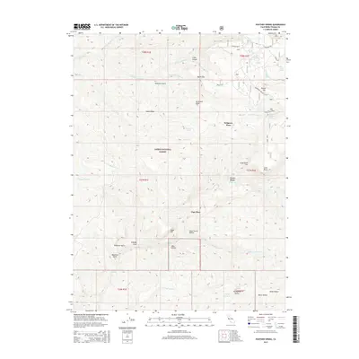
2015 Map of Panther Spring
USGS Topo · Published 2015About this map
Lassen National Forest terrain dominates this portion of Tehama County, where a network of springs and canyons defines the drainage patterns of the southern Cascades. The map highlights a series of isolated homesteads or historic sites including Peligreen Place, Avery Place, and Pape Place, which sit amid a landscape of significant elevation changes. Transport through this territory is marked by Ponderosa Way, a historic truck trail that skirts Round Mtn. This area is characterized by its complex hydrology, featuring numerous named water sources such as Panther Spring, Emigrant Spring, and Cave Spring. The presence of features like Stone Corral Hollow and Twentymile Hollow suggests a history of livestock management and movement through these canyons. Notable geographical markers like Kingsley Cove and Bear Canyon provide a detailed look at the drainage into Mill Creek and the N Fork Little Mill Cr.
Find a feature on this map
47 named features on this map. Tap any name to fly to it.
Don’t see what you’re looking for? This feature index may not catch every label — zoom into the map to look around manually.
Map Details
Editions of this 2015 Panther Spring Map
This is the sole edition of this map. No revisions or reprints were ever made.
Other maps of this area

1886 · Lassen Peak
USGS Topo · 1:250,000

1892 · Lassen Peak
USGS Topo · 1:250,000

1894 · Lassen Peak
USGS Topo · 1:250,000

1935 · Paynes Creek
USGS Topo · 1:96,000

1941 · Mineral
USGS Topo · 1:125,000
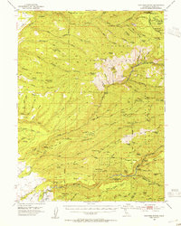
1953 · Panther Spring
USGS Topo · 1:62,500

1955 · Westwood
USGS Topo · 1:250,000

1956 · Lassen Peak
USGS Topo · 1:62,500

1956 · Manton
USGS Topo · 1:62,500

1958 · Westwood
USGS Topo · 1:250,000