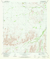
1980 Map of Panther Tank
USGS Topo · Published 1980About this map
Nineteen Draw and Monument Draw carve a network of drainage patterns across this Pecos County landscape, as documented in the mid-1970s. The terrain is defined by its water management and aviation history, marked by the presence of Landing Strips and the prominent Panther Tank in the western reaches. The isolation of the region necessitated self-sufficient infrastructure, evidenced by the Ellis Windmill and various wells and drill holes that speak to the search for resources in the arid Trans-Pecos environment. Smaller seasonal drainages like Burner Draw, Carlos Draw, and Cox Draw converge toward the south, illustrating the complex natural irrigation of the desert floor before any modern development altered these ancient paths.
Find a feature on this map
11 named features on this map. Tap any name to fly to it.
Don’t see what you’re looking for? This feature index may not catch every label — zoom into the map to look around manually.
Map Details
Editions of this 1980 Panther Tank Map
This is the sole edition of this map. No revisions or reprints were ever made.
Other maps of this area

1920 · Longfellow
USGS Topo · 1:125,000

1923 · Sierra Madera
USGS Topo · 1:62,500

1928 · Comanche Spring
USGS Topo · 1:125,000

1954 · Fort Stockton
USGS Topo · 1:250,000

1958 · Fort Stockton
USGS Topo · 1:250,000

1968 · Busher Canyon
USGS Topo · 1:24,000

1968 · Ebers Camp
USGS Topo · 1:24,000
1968 · Reininger Draw
USGS Topo · 1:24,000

1973 · Fort Stockton
USGS Topo · 1:250,000
1980 · Sierra Madera SE
USGS Topo · 1:24,000