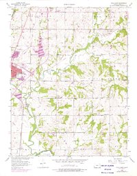
1956 Map of Paola East
USGS Topo · Published 1976About this map
Paola stands at a busy rail crossroads in eastern Kansas, where the Missouri Pacific and St Louis San Francisco Railroad intersect. The town’s social fabric is visible through institutions like the Ursuline Academy and St Patricks Sch, while the surrounding countryside is dotted with small rural education centers such as Baker Sch and Beaver Creek Sch. The landscape is defined by the winding course of Bull Creek and Wea Creek, which flow southward toward the Marais Des Cygnes River at the map's southern edge.
Find a feature on this map
39 named features on this map. Tap any name to fly to it.
Don’t see what you’re looking for? This feature index may not catch every label — zoom into the map to look around manually.
Map Details
Editions of this 1956 Paola East Map
2 editions found
Other maps of this area

1887 · Olathe
USGS Topo · 1:125,000

1887 · Mound City
USGS Topo · 1:125,000

1893 · Mound City
USGS Topo · 1:125,000

1893 · Olathe
USGS Topo · 1:125,000

1947 · Lawrence
USGS Topo · 1:250,000

1950 · Lawrence
USGS Topo · 1:250,000

1956 · Bucyrus
USGS Topo · 1:24,000

1956 · Paola East
USGS Topo · 1:24,000

1956 · Lawrence
USGS Topo · 1:250,000
1957 · Paola West
USGS Topo · 1:24,000