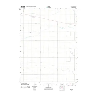
2010 Map of Paoli
USGS Topo · Published 2010About this map
Paoli occupies the northern edge of this high plains landscape, situated along a primary road and rail corridor in Phillips County. The town is defined by a rigid grid of agricultural roads, including County Rd 26 and County Rd 19, which segment the terrain into precise sections. Historically significant sites like the Posegate Cemetery offer grounding for genealogical research in this rural pocket of Colorado. The hydrology of the area is shaped by the intermittent paths of North Fork Frenchman Creek, South Fork Frenchman Creek, and Sandy Creek, which meander through the prairie. This 2010 survey reflects a landscape deeply committed to agricultural production, where the network of county roads provides the essential structure for the local economy and movement between the scattered farmsteads.
Find a feature on this map
21 named features on this map. Tap any name to fly to it.
Don’t see what you’re looking for? This feature index may not catch every label — zoom into the map to look around manually.
Map Details
Editions of this 2010 Paoli Map
This is the sole edition of this map. No revisions or reprints were ever made.
Other maps of this area

1954 · Sterling
USGS Topo · 1:250,000

1958 · Sterling
USGS Topo · 1:250,000

1962 · Holyoke NE
USGS Topo · 1:24,000

1962 · Haxtun East
USGS Topo · 1:24,000

1962 · Holyoke NW
USGS Topo · 1:24,000

1971 · Paoli
USGS Topo · 1:24,000

1971 · Holyoke
USGS Topo · 1:24,000

1971 · Fiddler Peak
USGS Topo · 1:24,000

1971 · Wauneta NE
USGS Topo · 1:24,000

1971 · Clarkville NE
USGS Topo · 1:24,000