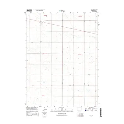
2016 Map of Paoli
USGS Topo · Published 2016About this map
Paoli occupies the northern reaches of this Phillips County landscape, situated along the primary corridor of Highway 6 and Dee St. This agricultural region is defined by a series of intermittent waterways, including the N Fork Frenchman Cr and S Fork Frenchman Cr, which carve shallow paths through the high plains. A significant local landmark for genealogists and historians is the Posegate Cem, located south of the main settlement along Co RD 22. Further south, the Frenchman Creek Reservoir and the drainage of Sandy Cr represent the vital water management infrastructure of this rural territory. The map details a rigid grid of county roads, such as Co RD 14 and Co RD 31, that organize the vast sections of the Colorado plains during the early twenty-first century.
Find a feature on this map
27 named features on this map. Tap any name to fly to it.
Don’t see what you’re looking for? This feature index may not catch every label — zoom into the map to look around manually.
Map Details
Editions of this 2016 Paoli Map
This is the sole edition of this map. No revisions or reprints were ever made.
Other maps of this area

1954 · Sterling
USGS Topo · 1:250,000

1958 · Sterling
USGS Topo · 1:250,000

1962 · Holyoke NE
USGS Topo · 1:24,000

1962 · Haxtun East
USGS Topo · 1:24,000

1962 · Holyoke NW
USGS Topo · 1:24,000

1971 · Paoli
USGS Topo · 1:24,000

1971 · Holyoke
USGS Topo · 1:24,000

1971 · Fiddler Peak
USGS Topo · 1:24,000

1971 · Wauneta NE
USGS Topo · 1:24,000

1971 · Clarkville NE
USGS Topo · 1:24,000