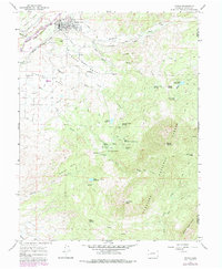
1965 Map of Paonia
USGS Topo · Published 1985About this map
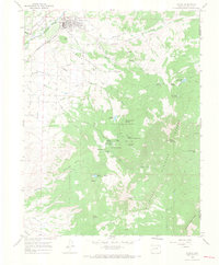
Agricultural life in the mid-1960s centers around Paonia and the fertile benches of Stewart Mesa and Lamborn Mesa. The North Fork Gunnison River and an intricate network of irrigation, including the Farmers Ditch and several long aqueducts, sustain the orchards and farms of this high mountain valley. Transportation and recreation of the era are marked by the Denver and Rio Grande Western railroad corridor and a local Drive-in Theater just west of town.
Find a feature on this map
56 named features on this map. Tap any name to fly to it.
Don’t see what you’re looking for? This feature index may not catch every label — zoom into the map to look around manually.
Map Details
Editions of this 1965 Paonia Map
5 editions found
Other maps of this area

1938 · Mt. Gunnison
USGS Topo · 1:48,000

1945 · Mount Gunnison
USGS Topo · 1:62,500

1956 · Montrose
USGS Topo · 1:250,000

1959 · Montrose
USGS Topo · 1:250,000

1960 · Montrose
USGS Topo · 1:250,000

1964 · Minnesota Pass
USGS Topo · 1:24,000
1964 · Somerset
USGS Topo · 1:24,000
1965 · Gray Reservoir
USGS Topo · 1:24,000

1965 · Mount Guero
USGS Topo · 1:24,000
1965 · Paonia
USGS Topo · 1:24,000