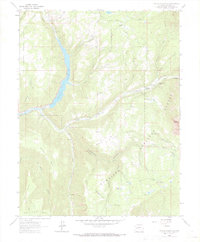
1964 Map of Paonia Reservoir
USGS Topo · Published 1984About this map
Paonia Reservoir dominates this mid-1960s landscape, serving as a central catchment for the Muddy Creek and North Fork Gunnison River systems. This region of the Gunnison National Forest is characterized by sharp elevation changes, where high plateaus like Raven Mesa and Snowshoe Mesa drop into deep drainages. The map captures a moment of active forest management and local ranching, indicated by the Anthracite Creek Guard Station and the Hotchkiss Ranch to the south.
Find a feature on this map
41 named features on this map. Tap any name to fly to it.
Don’t see what you’re looking for? This feature index may not catch every label — zoom into the map to look around manually.
Map Details
Editions of this 1964 Paonia Reservoir Map
4 editions found
Other maps of this area

1888 · Anthracite
USGS Topo · 1:62,500

1889 · Anthracite
USGS Topo · 1:62,500

1893 · Anthracite
USGS Topo · 1:62,500

1894 · Anthracite
USGS Topo · 1:62,500

1938 · Mt. Gunnison
USGS Topo · 1:48,000

1945 · Mount Gunnison
USGS Topo · 1:62,500

1956 · Montrose
USGS Topo · 1:250,000

1957 · Leadville
USGS Topo · 1:250,000

1959 · Leadville
USGS Topo · 1:250,000

1959 · Montrose
USGS Topo · 1:250,000