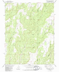
1985 Map of Papoose Canyon
USGS Topo · Published 1985About this map
Papoose Canyon and its many tributary drainages define this high desert landscape along the border of Utah and Colorado. Surveyed in the mid-1980s, the terrain is marked by prominent mesas and ridges including Bug Point and Squaw Point, with steep descents into Nancy Patterson Canyon and Ruin Canyon. The map reveals a land utilized for more than just its geography, noting scattered infrastructure like the Pack Trail in the south and several Drill Holes that suggest resource exploration across the state line.
Find a feature on this map
30 named features on this map. Tap any name to fly to it.
Don’t see what you’re looking for? This feature index may not catch every label — zoom into the map to look around manually.
Map Details
Editions of this 1985 Papoose Canyon Map
This is the sole edition of this map. No revisions or reprints were ever made.
Other maps of this area

1886 · Abajo
USGS Topo · 1:250,000

1892 · Abajo
USGS Topo · 1:250,000

1893 · Abajo
USGS Topo · 1:250,000

1955 · Verdure 4 NW
USGS Topo · 1:24,000

1955 · Verdure 4 SW
USGS Topo · 1:24,000

1956 · Cortez
USGS Topo · 1:250,000

1957 · Moqui NW
USGS Topo · 1:24,000

1957 · Cedar 3 NW
USGS Topo · 1:24,000

1957 · Aneth 1 NE
USGS Topo · 1:24,000

1957 · Cedar 3 SW
USGS Topo · 1:24,000