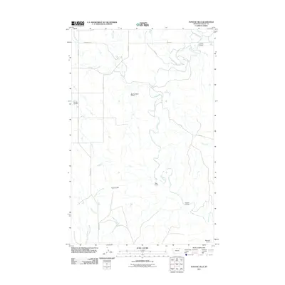
2011 Map of Papoose Hills
USGS Topo · Published 2011About this map
The Papoose Hills dominate this portion of Valley County, defining a landscape etched by a complex network of coulees and prairie drainage. The drainage pattern is led by Rock Creek, which meanders through the central terrain, joined by smaller tributaries such as Bog Coulee and Pasture Coulee. The naming of features like Big Coal Bank Coulee suggests the historic presence of surface-level resources that once influenced local exploration and land use in this part of Montana.
Find a feature on this map
20 named features on this map. Tap any name to fly to it.
Don’t see what you’re looking for? This feature index may not catch every label — zoom into the map to look around manually.
Map Details
Editions of this 2011 Papoose Hills Map
This is the sole edition of this map. No revisions or reprints were ever made.
Other maps of this area

1919 · Boundary
USGS Topo · 1:125,000

1954 · Glasgow
USGS Topo · 1:250,000

1957 · Glasgow
USGS Topo · 1:250,000

1958 · Glasgow
USGS Topo · 1:250,000

1984 · Bjornberg Bridge
USGS Topo · 1:24,000

1984 · Snake Creek School
USGS Topo · 1:24,000

1984 · Opheim
USGS Topo · 1:100,000
1984 · Jones Coulee
USGS Topo · 1:24,000

1984 · Coulter Coulee
USGS Topo · 1:24,000
1984 · Burnett Creek
USGS Topo · 1:24,000