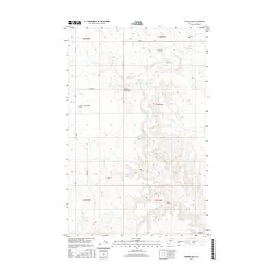
2017 Map of Papoose Hills
USGS Topo · Published 2017About this map
Papoose Hills dominate the southern landscape of this remote section of Valley County, where a complex network of coulees and seasonal creeks defines the drainage patterns toward the Milk River valley. The terrain is marked by significant geographic depressions including Big Coal Bank Coulee and Bog Coulee, which serve as natural landmarks in this high plains environment. Early rural transit is evidenced by cattle-country thoroughfares such as Hinsdale N Rd and Jensen Rd, which provide access to the various sections of this arid ranchland. Water sources, essential for land use in this part of Montana, are mapped along Snake Cr and the winding Rock Creek, which carves through Rock Creek Canyon in the northeastern reaches. This record captures the modern distribution of family-named landmarks like Jensen Coulee and Jordan Coulee amidst the expansive township and range grid.
Find a feature on this map
27 named features on this map. Tap any name to fly to it.
Don’t see what you’re looking for? This feature index may not catch every label — zoom into the map to look around manually.
Map Details
Editions of this 2017 Papoose Hills Map
This is the sole edition of this map. No revisions or reprints were ever made.
Other maps of this area

1919 · Boundary
USGS Topo · 1:125,000

1954 · Glasgow
USGS Topo · 1:250,000

1957 · Glasgow
USGS Topo · 1:250,000

1958 · Glasgow
USGS Topo · 1:250,000

1984 · Bjornberg Bridge
USGS Topo · 1:24,000

1984 · Snake Creek School
USGS Topo · 1:24,000

1984 · Opheim
USGS Topo · 1:100,000
1984 · Jones Coulee
USGS Topo · 1:24,000

1984 · Coulter Coulee
USGS Topo · 1:24,000
1984 · Burnett Creek
USGS Topo · 1:24,000