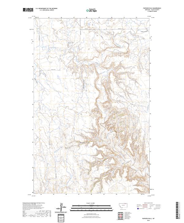
2024 Map of Papoose Hills
USGS Topo · Published 2024About this map
Papoose Hills and the winding drainages of Valley County define this northern Montana landscape. The geography is dominated by an intricate network of coulees and canyons, where the terrain falls away from the high plateaus into features like Rock Creek Canyon and Big Coal Bank Coulee. This modern mapping captures the essential hydrological patterns of the region, tracing the paths of Little Snake Creek and the East Fork Cash Creek as they navigate the breaks.
Find a feature on this map
25 named features on this map. Tap any name to fly to it.
Don’t see what you’re looking for? This feature index may not catch every label — zoom into the map to look around manually.
Map Details
Editions of this 2024 Papoose Hills Map
This is the sole edition of this map. No revisions or reprints were ever made.
Other maps of this area

1919 · Boundary
USGS Topo · 1:125,000

1954 · Glasgow
USGS Topo · 1:250,000

1957 · Glasgow
USGS Topo · 1:250,000

1958 · Glasgow
USGS Topo · 1:250,000

1984 · Bjornberg Bridge
USGS Topo · 1:24,000

1984 · Snake Creek School
USGS Topo · 1:24,000

1984 · Opheim
USGS Topo · 1:100,000
1984 · Jones Coulee
USGS Topo · 1:24,000

1984 · Coulter Coulee
USGS Topo · 1:24,000
1984 · Burnett Creek
USGS Topo · 1:24,000